Geoscience
Satellite Mission Design
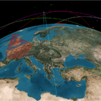
Earth observation satellites have emerged as the preeminent tool for consistent and high-resolution imagery. The eyeON mission is designed to provide rapid on-demand sub three meter resolution imagery as well as generate a database of regions of interest. In the following document, the eyeON team proposes a multi-use satellite observation system capable of servicing many constituents in different areas of study.
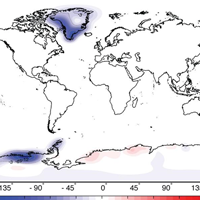
GRACE: melting land ice
In the context of a presentation for the ESPACE program at TUM, the GRACE mission and its measurement technique, as well as its use for the geoscientific community for melting land ice oberservations is presented and discussed. For this purpose several studies have been analysed and summarized.